|
|
|
| About the City | About the District |
|
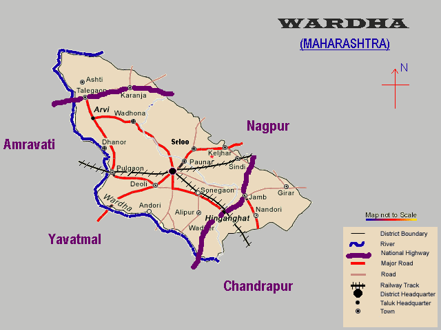
| About the District : - |
| Area : 6310 Sq. Km. |
| Longitude : 78.33 to 79.15 East |
| Latitude : 20.18 to 21.21 North |
| Population : 10,67,357 (1991 cencus) |
| STD Code : 07152 |
| Length of Roads : 432 Km. |
| Taluka Places : 8 |
| About the City : - |
| Sewagram Ashram : 7 Km. |
| Pavnar : 10 Km. |
| Magan Sangralaya : 1 Km. |
| Gitai Mandir : 3 Km. |
| Shantistup : 3 Km. |
| Rashtra Bhasha Prachar Samiti : 1 Km. |
| Railway Station : 0.5 Km. |
| | Home | About Us | Contact Us | Feedback | |
copyright © 2001 |